Drone · LiDAR · Reality capture · Engineering · AI analytics
Reality capture that ends in answers.
We capture sites with drones, LiDAR and ground scanners. Then we process the data, analyze it with AI, and deliver the models, measurements, engineering drawings and reports your team acts on.
15 industries50+ use casesCapture to BIM under one roof
How a project runs
The flight takes a day. The value comes from everything after it.
Plenty of providers can put an aircraft over a site. Our focus is the processing, analysis and engineering that turn raw imagery and scans into something an engineer, project manager or inspector can use.
Capture
Drone photogrammetry, aerial and terrestrial LiDAR, thermal, multispectral and interior scanning, planned around the deliverable, with ground control and check points.
Process
Imagery and scans become georeferenced point clouds, orthomosaics, elevation models, meshes and 3D digital twins.
Analyze
AI finds, counts and measures. Our analysts verify every finding and rank it by severity before it reaches you.
Deliver
Findings, models and engineering deliverables on a hosted platform, plus exports to your CAD, BIM and GIS tools.
Inside a delivery
See what you actually receive
An active commercial construction site, four weeks apart. Drag across the map to compare visits, switch either side to elevation or cut and fill, hover to read elevations, and click a finding to locate it.
The full platform also hosts the 3D model and point cloud, compares every visit, and exports to CAD, BIM and GIS.
Industries
Fifteen industries, one way of working
Pick an industry to see a typical site and what we deliver for it. Drag the model to rotate it.
Services
From the flight plan to the stamped drawing
Drone, LiDAR and scanning
Aerial photogrammetry, aerial and terrestrial LiDAR, thermal, multispectral, and interior scanning.
Capture →Point clouds, maps and digital twins
Georeferenced point clouds, orthomosaics, terrain models, meshes and navigable 3D twins.
Processing →Findings, counts and measurements
Asset inventories, change detection, volumes, progress and condition findings, verified by analysts.
Analytics →Drawings, models and analysis
Scan to BIM, as-built and construction drawings, site plans, and structural and mount analysis.
Engineering →A hosted platform for your team
View, measure, compare and share in a browser. Export to CAD, BIM and GIS when you need files.
Delivery →Already have imagery or scans?
Send us data your own team or another provider collected. We process, analyze and engineer from it.
Send us your data →Engineering and BIM
Design drawings, draped on what is really there
We georeference the civil design set and overlay it on the captured site, so owners and contractors can see layout, grading, utilities and lighting against current conditions. Turn each discipline on or off below.
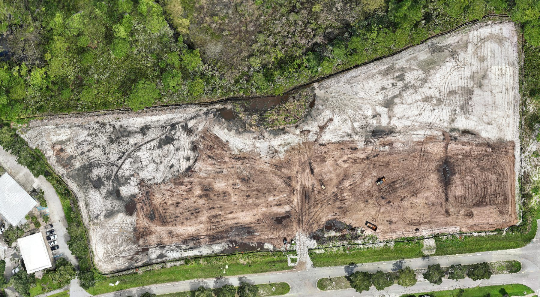
Commercial project, Florida. Design sheets C-100 to C-300 and E-100, georeferenced from the PDF set; fill layer is the current surface compared with the design surface, ±3 ft. Client details withheld.
From capture to drawings
The data doesn't stop at a point cloud
Our engineering team turns captured conditions into the drawings, models and analysis your project needs, from the same data that produced the twin. Nobody has to re-measure the site, and partner PE firms seal the work that requires it.
Use cases
Start from the question you need answered
Why Elevated Insights
One team from flight plan to final report
Processing is the core of the business
Analysis, engineering and reporting are what we do, not add-ons after the flight. You get answers, not a hard drive of raw photos.
AI that people check
Automated detection does the volume. Analysts review every finding before it reaches your team.
Data your whole team can open
Field crews, engineers and managers work from the same hosted model in a browser, with exports when they need files.
Repeatable over time
Fly the same site on a schedule and compare visits to track progress, change and condition.
Questions
Frequently asked
What does Elevated Insights do?
We capture sites and structures with drones, LiDAR and ground scanners. Then we process the data, analyze it with AI-assisted tools, and deliver the models, measurements, engineering drawings and reports that answer your question about the site.
Do you only fly drones?
No. We combine aerial photogrammetry and LiDAR with terrestrial, handheld and interior scanning, and with thermal and multispectral imaging when the job calls for it. Many projects use more than one method.
Can you work with data we already collected?
Yes. Send us imagery or scans from your own team or another provider, and we will process, analyze and engineer from them. We will tell you up front if the data can't support the deliverable you need.
How does the AI analysis work?
AI-assisted tools detect, count and measure features across the whole dataset. Our analysts then review the results, remove false positives, and rank findings by severity, so what reaches you has been checked by a person.
Do you provide engineering and BIM?
Yes. We deliver scan-to-BIM models, as-built and construction drawings, site plans, and structural and mount analysis, all built from the same captured data. Licensed professional engineers at our partner firms review and seal deliverables that require a stamp.
What will we receive?
Access to a hosted platform where your team can view, measure and share results, plus the files your tools use, such as LAS/LAZ, E57, GeoTIFF, OBJ, DWG, RVT, IFC and PDF reports.
How accurate is the data?
That depends on the deliverable, so we plan accuracy before the flight. We use surveyed ground control and independent check points and report the measured accuracy with each deliverable.
Can you capture the same site on a schedule?
Yes. Recurring captures use the same flight plan each visit, so results compare cleanly over time for progress, change and condition tracking.
Do you work with drone pilots?
Yes. We work with independent Part 107 pilots across the United States. Every pilot is vetted before their first job, specialized work such as telecom requires additional training and certifications from our training team, and every flight goes through our quality review before processing. See Fly with us to apply.
For drone pilots
Fly with us
We work with professional Part 107 pilots across the country, backed by our own training team and quality program. If you fly carefully and deliver complete data, we would like to hear from you.
Tell us about your site.
Share the location, what you need to know, and when. We will come back with a capture plan and the deliverables that answer it.