Case studies / Construction progress, Texas
Weekly construction progress monitoring on a Texas commercial site
Repeat drone surveys of a commercial site in the grading phase, aligned to each other and to the pre-construction surface, so earthwork, stockpiles and drainage are measured every visit instead of estimated.
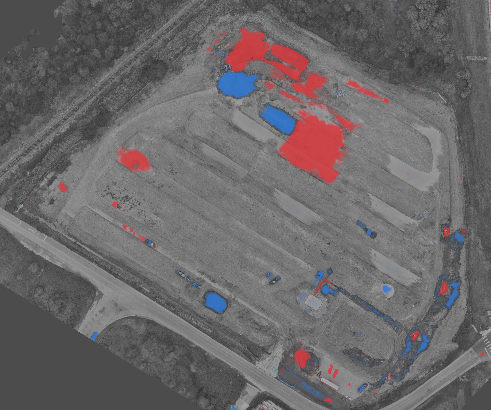
The question
The owner and contractor needed one shared, measurable record of the site each week: how much earth had moved, whether the detention pond and building pad were reaching design, and what needed attention before the next visit.
What we captured
A drone mapping flight on each visit, processed into an orthomosaic, an elevation model and a 3D point cloud. Every visit is aligned to the first, so the surfaces can be subtracted directly. On this site the aligned visits agreed to within 0.02 ft vertically.
What the analysis found at visit 5
Earthwork to date: 21,712 CY cut, 1,158 CY fill against the pre-construction surface.
Stockpiles: 13 piles, 1,979 CY. +206 CY since the last visit; largest pile 694 CY.
Detention pond excavated to design. Floor 641.1 ft vs design toe 641.0 ft; 2,080 CY removed this week.
Pad grade check. 4.3 ac pad, 0.27% fall to the northeast, 0.9 ft RMS from best-fit plane.
Ponding on the graded pad. 7 patches, 9,900 sq ft, about 22,000 gal; median depth 0.3 ft. Flagged for drainage before the next rain.
What the team received
Side-by-side and cut-and-fill views of any two visits, elevation readouts anywhere on the site, and numbered findings ranked by severity, all in a browser. The same data feeds volume reports and as-built comparisons as the job moves toward completion.
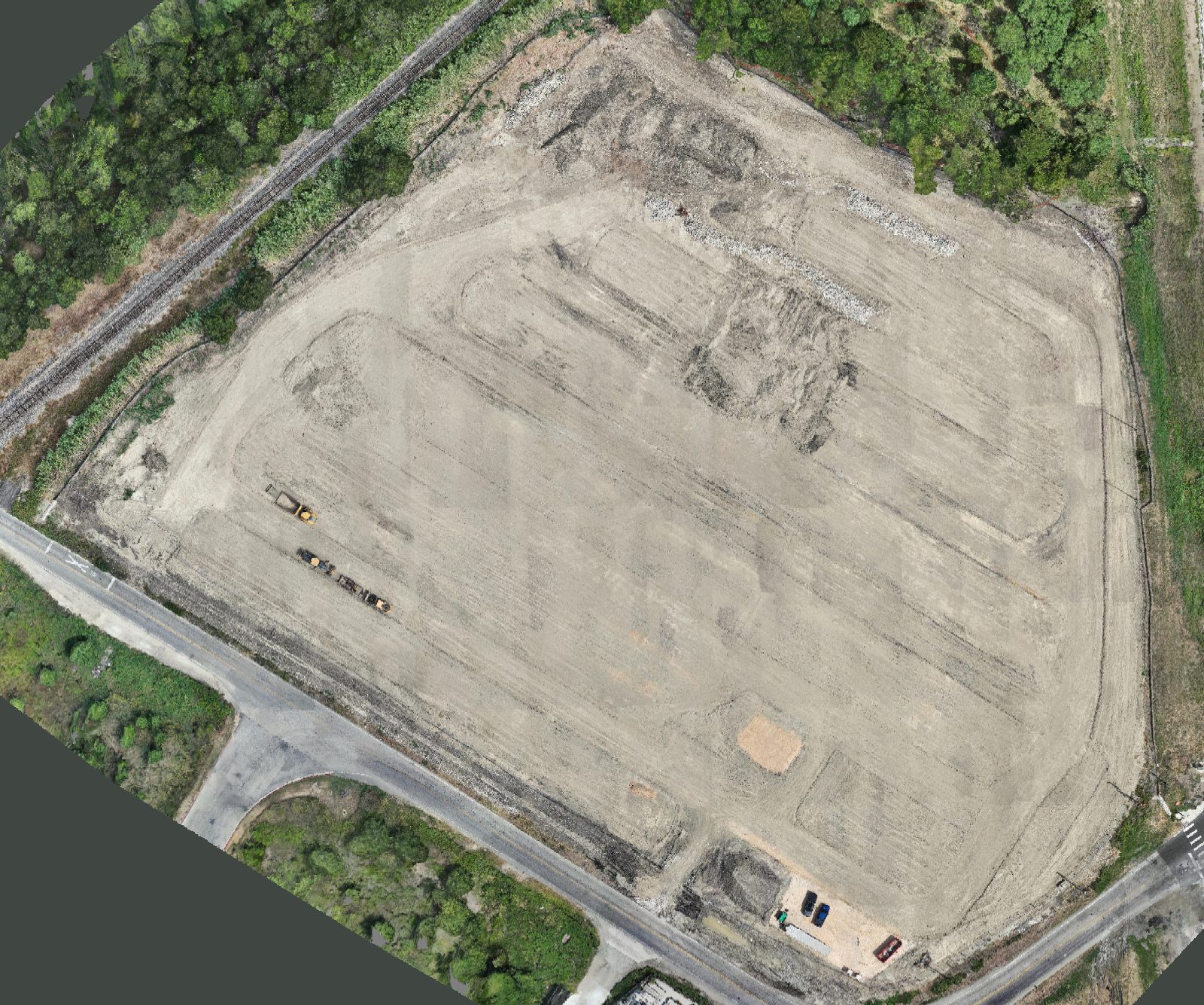
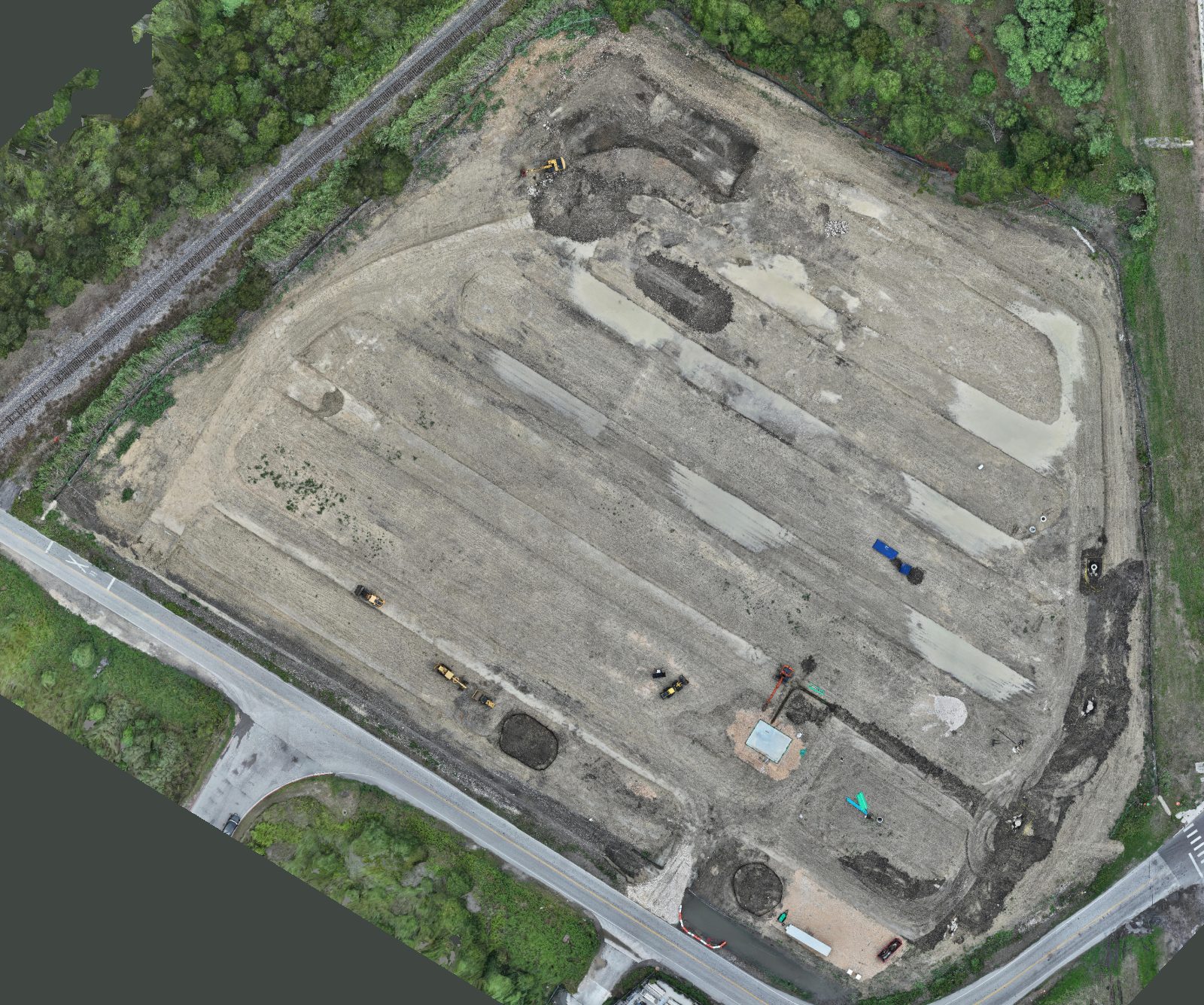
Client details withheld. See more work like this for this industry.
Want this for your site?
Share a location and what you need to know. We will reply with a capture plan, the deliverables and a quote.